Pipeline route, tunneler (UMASW)


Objectives


Use the properties of marine surface waves, giving access to the shear velocity values, in order to characterize the sediments along the path of a tunneler crossing a river.

Equipment

  • 48-channel seismic recorder
  • Hydrophones
  • 48-channel marine seismic streamers
  • Mini G Gun Sercel seismic source


Measurements

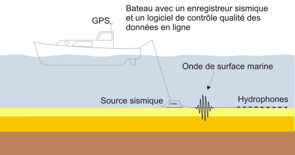
The equipment is towed on the sea bottom and seismic shots are carried out at constant distance. The seismic data are recorded on board and an online quality control is carried out in order to modify, if necessary, on the acquisition parameters.


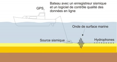
  • Acquisition set-up for marine surface wave (UMASW)

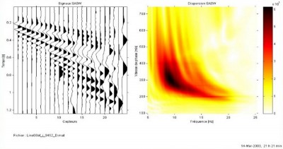
  • On-line in-house surface wave data processing software (signal and dispersion)


Results

The use of a tunneler was planned for a pipeline route crossing a large french river. To define the best route for the project, a marine seismic campaign using the surface wave and the refraction has been performed by SismOcean. The aim was to localize some possible paleo-channels and to find the appropriate geological layers for the tunneler.

These measurements were carried out using a dynamic acquisition with equipment dragged on the river bottom by a vessel. A grid acquisition composed of parallel lines in the river direction gave access to a 3D block of shear wave velocities data with which it was possible to extract the information along the pipeline route crossing the river.