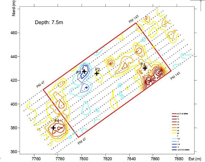
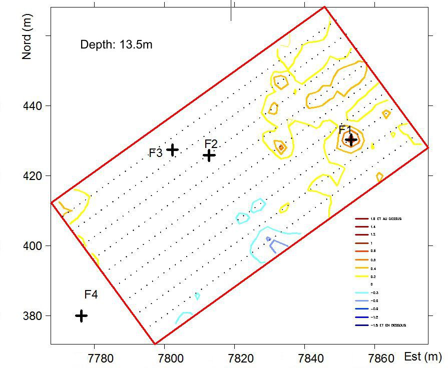
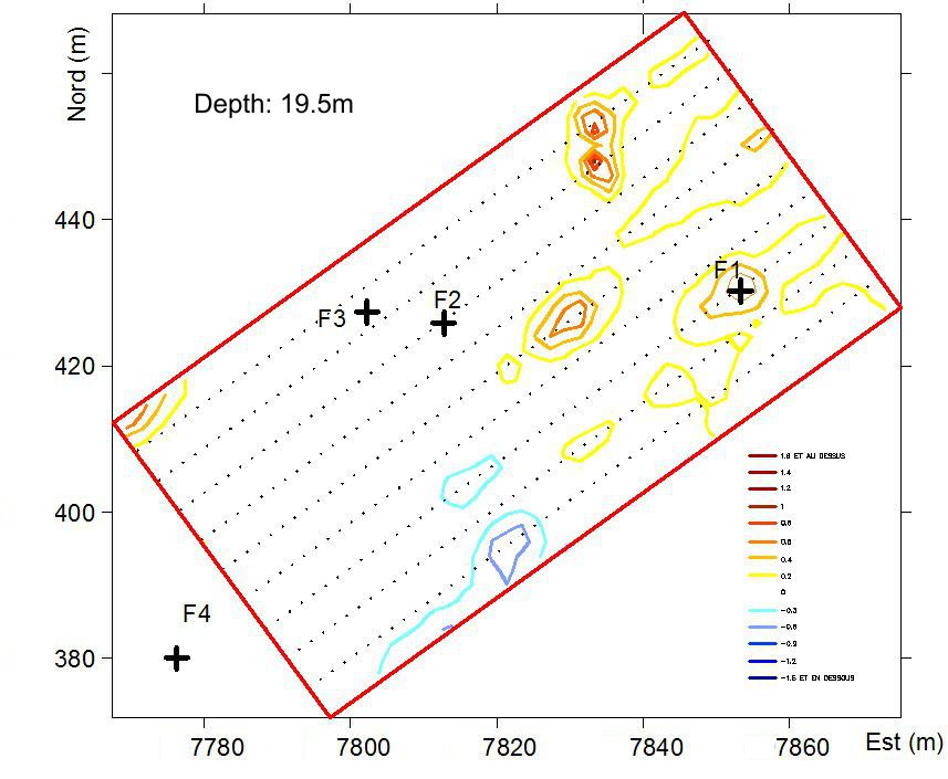
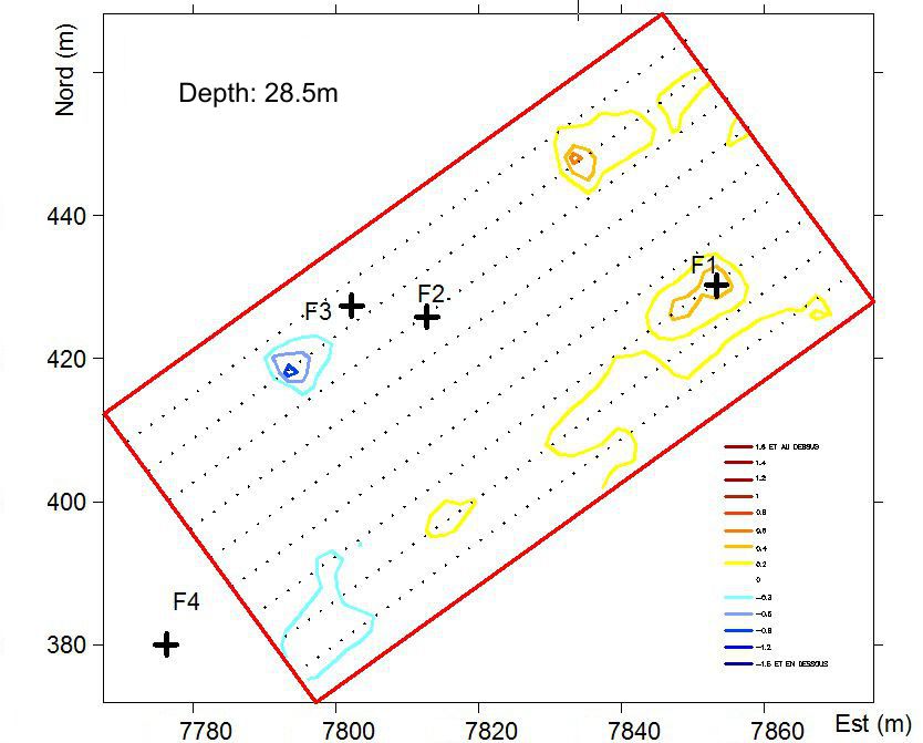
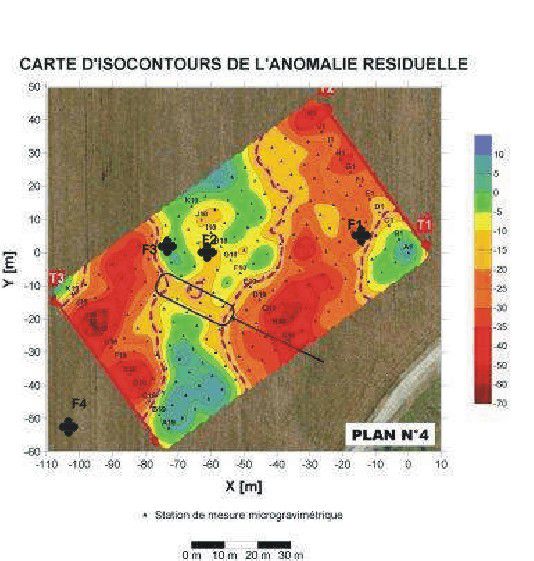
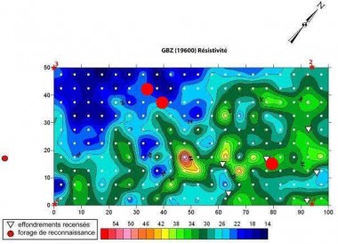
This electromagnetic prospecting method allows the recognition of conductive or resistant areas at depths of up to several tens of meters. The results obtained did not allow the implementation of control boreholes.
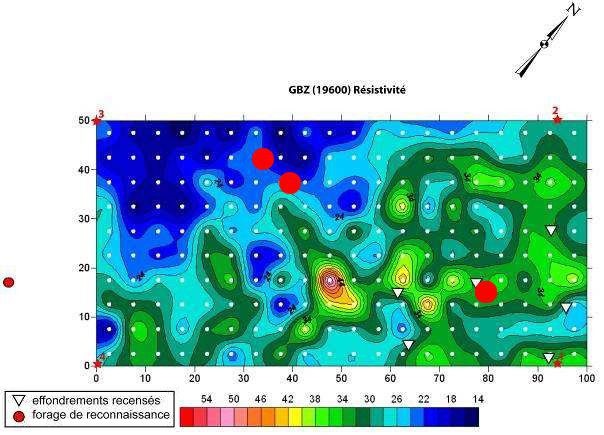
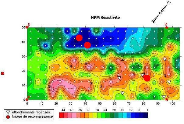
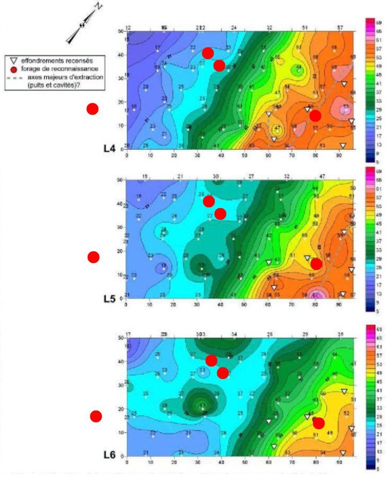
The four boreholes defined with the results of DCOS analysis are represented by red circles
 Profils Nord-Sud
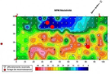 Profils Est-Ouest