Marine seismic refraction gave access to vertical sections highlighting the geological units defined by the parameter of velocities of compression waves (P wave).
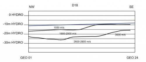
Seismic refraction (P wave velocities)
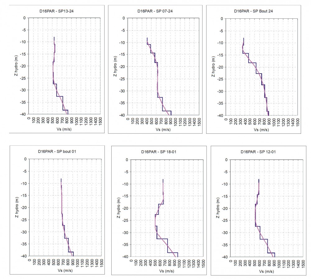
The marine surface wave gave for every seismic shot locations one or two vertical profiles of the shear wave velocities of the medium as a function of the depth. Locally inversion of velocities have been identified which is not possible by seismic refraction measurements.
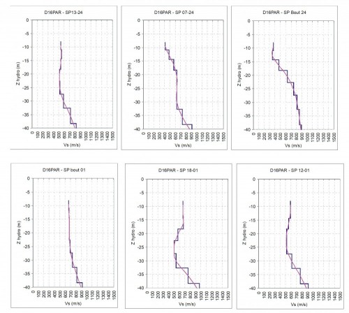
Marine surface wave – UMASW (shear wave velocities)